
Magnitude 4.6 KEPULAUAN TALAUD, INDONESIA
Sunday, April 19, 2009 at 09:58:29 UTC
Earthquake Density Maps
Earthquake Density
-
Average number of Earthquakes per Year per 12,300 km2, Magnitude 5 and Greater
Shallow Earthquakes: Depth 0-70 km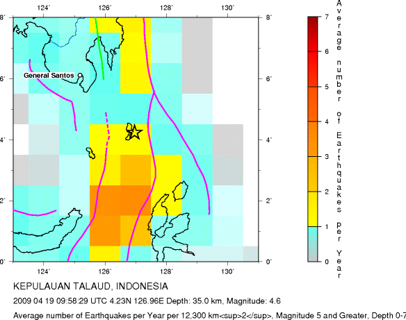
Major Tectonic Boundaries: Subduction Zones -purple, Ridges -red and Transform Faults -green
-
Average number of Earthquakes per Year per 12,300 km2, Magnitude 5 and Greater
All Depths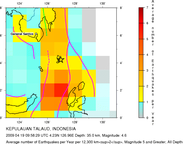
Major Tectonic Boundaries: Subduction Zones -purple, Ridges -red and Transform Faults -green
Global Earthquake Density Maps
Preliminary Earthquake Report
U.S. Geological Survey, National Earthquake Information Center
World Data Center for Seismology, Denver
