
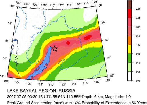
Magnitude 4.0 LAKE BAYKAL REGION, RUSSIA
Thursday, July 05, 2007 at 00:20:13 UTC
Seismic Hazard Map
Major Tectonic Boundaries: Subduction Zones -purple, Ridges -red and Transform Faults -green
Global Seismic Hazard Assessment Program -GSHAP
Preliminary Earthquake Report
U.S. Geological Survey, National Earthquake Information Center
World Data Center for Seismology, Denver
