
Magnitude 3.9 OFF EAST COAST OF THE NORTH ISLAND, N.Z.
Monday, July 02, 2007 at 18:43:54 UTC
Earthquake Density Maps
Earthquake Density
-
Average number of Earthquakes per Year per 12,300 km2, Magnitude 5 and Greater
Shallow Earthquakes: Depth 0-70 km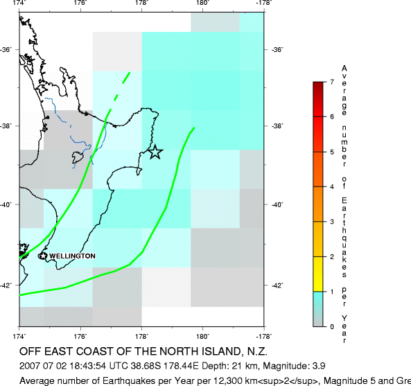
Major Tectonic Boundaries: Subduction Zones -purple, Ridges -red and Transform Faults -green
-
Average number of Earthquakes per Year per 12,300 km2, Magnitude 5 and Greater
All Depths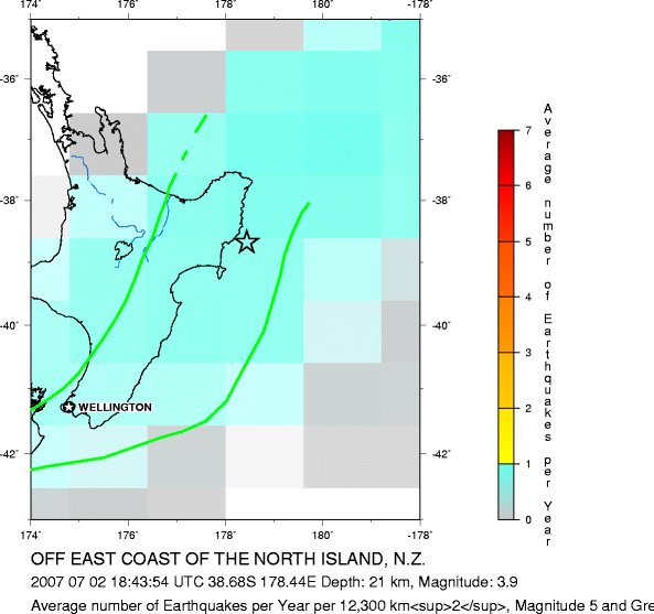
Major Tectonic Boundaries: Subduction Zones -purple, Ridges -red and Transform Faults -green
Global Earthquake Density Maps
Preliminary Earthquake Report
U.S. Geological Survey, National Earthquake Information Center
World Data Center for Seismology, Denver
