
Earthquake Density Maps
Magnitude 4.9 MINDANAO, PHILIPPINES
Thursday, January 26, 2012 at 15:47:19 UTC
-
Average number of Earthquakes per Year per 12,300 km2, Magnitude 5 and Greater
Intermediate Earthquakes: Depth 70-300 km
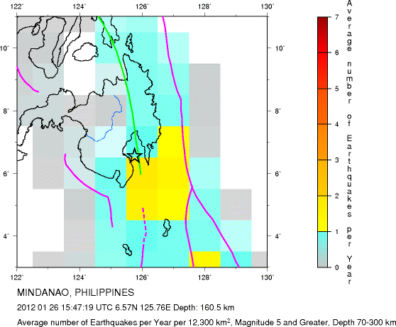
Major Tectonic Boundaries: Subduction Zones -purple, Ridges -red and Transform Faults -green

-
Average number of Earthquakes per Year per 12,300 km2, Magnitude 5 and Greater
All Depths
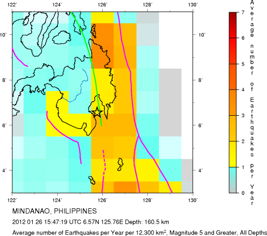
Major Tectonic Boundaries: Subduction Zones -purple, Ridges -red and Transform Faults -green
Global Earthquake Density Maps
Preliminary Earthquake Report
U.S. Geological Survey, National Earthquake Information Center
World Data Center for Seismology, Denver
