
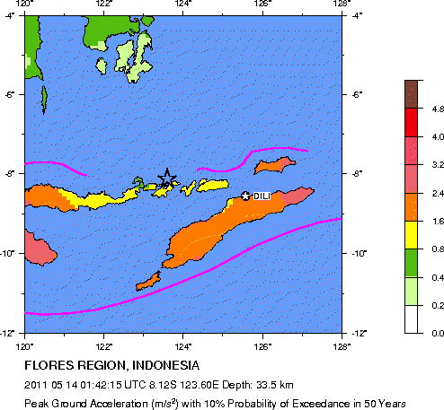
Seismic Hazard Map
Magnitude 5.1 FLORES REGION, INDONESIA
Saturday, May 14, 2011 at 01:42:15 UTC
Major Tectonic Boundaries: Subduction Zones -purple, Ridges -red and Transform Faults -green
Preliminary Earthquake Report
U.S. Geological Survey, National Earthquake Information Center
World Data Center for Seismology, Denver
