
Seismic Hazard Map
Magnitude 5.1 KEP. MENTAWAI REGION, INDONESIA
Tuesday, November 09, 2010 at 11:16:50 UTC
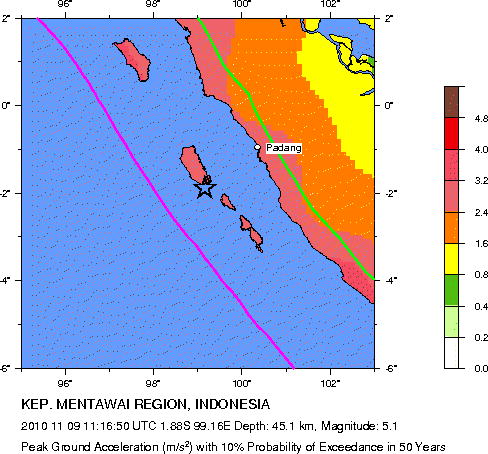
Major Tectonic Boundaries: Subduction Zones -purple, Ridges -red and Transform Faults -green
Preliminary Earthquake Report
U.S. Geological Survey, National Earthquake Information Center
World Data Center for Seismology, Denver
