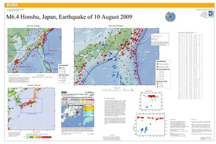
Poster of the Honshu, Japan Earthquake of 08 August 2009 - Magnitude 6.4
Tectonic Summary
The southern Honshu earthquake of August 10, 2009, occurred near the Suruga Trough, on or very near the boundary between the Philippine Sea plate and the Amur plate (sometimes viewed as part of the Eurasia plate). The source region lies just south of the triple junction of the Philippine Sea plate, the Amur plate, and the Okhotsk plate (sometimes viewed as part of the North America plate) and is tectonically complex. In the epicentral region, the Philippine Sea plate subducts west or northwest beneath the Amur plate. Both the subducting Philippine Sea plate and the overriding Amur plate are seismically active due to high intraplate stresses, and the thrust-fault boundary between the plates is seismogenic.
Present estimates of the earthquake's epicenter, focal-depth, and focal-mechanism suggest that the shock did not occur on the plate interface, but they do not permit us to confidently determine if the earthquake occurred within the Philippine Sea plate or the Amur plate.
Downloads

Settings
The posters may be downloaded for viewing or for printing on a color
plotter. Adobe PDF (.pdf) format files are provided. Adobe Acrobat 6.0 or
higher is required for viewing the PDF file on a computer monitor and for
printing the PDF map graphic. IMPORTANT: The PDF map graphic was produced
using TrueType fonts; change the following setting to:
Page(Print)Setup<Properties<Layout<Advanced<Graphic<TrueTypeFont<DownloadAsSoftFont
Attention MAC users: If you have problems viewing the pdf files, please download the pdf file and view it in the lastest verion of Adobe Acrobat.

