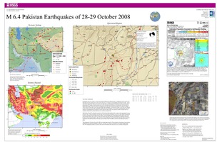
Poster of the Pakistan Earthquakes of 28-29 October 2008 - Magnitude 6.4
Tectonic Summary
Earthquakes and active faults in western and northern Pakistan and adjacent parts of Afghanistan are the result of the India plate moving northward at a rate of about 40 mm/yr (1.6 inches/yr) and colliding with the Eurasia plate. Along the northern edge of the Indian subcontinent, the India plate is subducting beneath the Eurasia plate, causing uplift that produces the highest mountain peaks in the world, including the Himalayan, the Karakoram, the Pamir and the Hindu Kush ranges. West and south of the Himalayan front, the relative motion between the two plates is oblique, which results in strike-slip, reverse-slip, and oblique-slip earthquakes. The pattern of elastic waves that were radiated by the October 28 and 29, 2008, earthquakes implies that each earthquake was the result of predominantly strike-slip faulting. Seismographically recorded waveforms imply that the shocks were caused by either left-lateral slip on a northeast-striking fault or right-lateral slip on a northwest-striking fault.
The October 28 and 29 earthquakes occurred in the Sulaiman fold-and-thrust belt, a region where geologically young (Tertiary) sedimentary rocks have been folded and squeezed by forces associated with the India-Eurasia collision. The earthquakes are located approximately 80 km east of the 650-km-long Chaman fault, which is a major left-lateral strike-slip fault that accommodates a significant amount of the slip across the plate boundary. The occurrence of the earthquakes suggests that other strike-slip faults are present beneath the fold-and-thrust belt and that they accommodate some of the relative motion of the India and Eurasia plates.
The earthquakes of October 28 and 29, 2008, are located approximately 50 km northeast of the region of most intense damage from the Pakistan earthquake of May 30, 1935 (M 7.6), which is estimated to have killed 30,000 people. The 1935 earthquake probably occurred as the result of left-lateral strike-slip motion on a northeast-striking fault.
Downloads

Settings
The posters may be downloaded for viewing or for printing on a color
plotter. Adobe PDF (.pdf) format files are provided. Adobe Acrobat 6.0 or
higher is required for viewing the PDF file on a computer monitor and for
printing the PDF map graphic. IMPORTANT: The PDF map graphic was produced
using TrueType fonts; change the following setting to:
Page(Print)Setup<Properties<Layout<Advanced<Graphic<TrueTypeFont<DownloadAsSoftFont
Attention MAC users: If you have problems viewing the pdf files, please download the pdf file and view it in the lastest verion of Adobe Acrobat.

