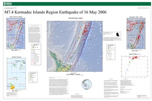
Poster of the Kermadec Islands Region Earthquake of 16 May 2006 - Magnitude 7.4
Tectonic Summary
The broad-scale tectonics of the earthquake region are dominated by the relative convergence of the Pacific and Australia plates. The Pacific plate subducts westward beneath the Australia plate at the Tonga trench. At the latitude of the earthquake, the Pacific plate moves westward with respect to the interior of the Australia plate at a velocity of about 55 mm/year. The eastern edge of the broad Australia plate may itself be viewed as a collection of small plates or microplates that move with respect to each other and with respect to the Pacific plate and the Australia plate interior.
In terms of numbers of earthquakes, the broad-scale Australia/ Pacific plate boundary is one of the most active in the world. Earthquakes occur on the thrust-fault boundary between the Australia and Pacific plates, within the Pacific plate, and within and on the boundaries of the small plates that together compose the eastern edge of the overall Australia plate. On the basis of currently available information, we infer that the earthquake of May 16, 2006, occurred within the subducted Pacific plate beneath the overriding eastern edge of the Australia plate.
Downloads

Settings
The posters may be downloaded for viewing or for printing on a color
plotter. Adobe PDF (.pdf) format files are provided. Adobe Acrobat 6.0 or
higher is required for viewing the PDF file on a computer monitor and for
printing the PDF map graphic. IMPORTANT: The PDF map graphic was produced
using TrueType fonts; change the following setting to:
Page(Print)Setup<Properties<Layout<Advanced<Graphic<TrueTypeFont<DownloadAsSoftFont
Attention MAC users: If you have problems viewing the pdf files, please download the pdf file and view it in the lastest verion of Adobe Acrobat.

