
Magnitude 4.8 - SOUTH OF THE FIJI ISLANDS
2012 January 30 19:56:07 UTC
Earthquake Details
- This event has been reviewed by a seismologist.
| Magnitude | 4.8 |
|---|---|
| Date-Time |
|
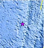
| Location | 25.056°S, 179.881°W |
| Depth | 483.2 km (300.3 miles) |
| Region | SOUTH OF THE FIJI ISLANDS |
| Distances | 503 km (312 miles) SSW of Ndoi Island, Fiji 505 km (313 miles) NNW of Raoul Island, Kermadec Islands 647 km (402 miles) SW of NUKU`ALOFA, Tonga 1405 km (873 miles) NNE of Auckland, New Zealand |
| Location Uncertainty | horizontal +/- 38.1 km (23.7 miles); depth +/- 15.4 km (9.6 miles) |
| Parameters | NST= 18, Nph= 20, Dmin=>999 km, Rmss=0.86 sec, Gp=216°, M-type=body wave magnitude (Mb), Version=3 |
| Source |
|
| Event ID | usc0007tz7 |
- Did you feel it? Report shaking and damage at your location. You can also view a map displaying accumulated data from your report and others.
Earthquake Maps


Scientific & Technical Information
 Historic Moment Tensor Solutions
- Preliminary Earthquake Report
- U.S. Geological Survey, National Earthquake Information Center:
World Data Center for Seismology, Denver
