
Magnitude 4.6 - MOLUCCA SEA
2012 January 13 10:24:02 UTC
Earthquake Details
- This event has been reviewed by a seismologist.
| Magnitude | 4.6 |
|---|---|
| Date-Time |
|
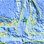
| Location | 1.378°N, 126.487°E |
| Depth | 115.2 km (71.6 miles) |
| Region | MOLUCCA SEA |
| Distances | 119 km (73 miles) NW of Ternate, Moluccas, Indonesia 183 km (113 miles) E of Manado, Sulawesi, Indonesia 1103 km (685 miles) N of DILI, Timor-Leste 1583 km (983 miles) SSE of MANILA, Philippines |
| Location Uncertainty | horizontal +/- 23.3 km (14.5 miles); depth +/- 16.9 km (10.5 miles) |
| Parameters | NST= 15, Nph= 16, Dmin=119.1 km, Rmss=0.65 sec, Gp= 94°, M-type=body wave magnitude (Mb), Version=3 |
| Source |
|
| Event ID | usc0007k9a |
- Did you feel it? Report shaking and damage at your location. You can also view a map displaying accumulated data from your report and others.

Earthquake Maps


Scientific & Technical Information
 Historic Moment Tensor Solutions
- Preliminary Earthquake Report
- U.S. Geological Survey, National Earthquake Information Center:
World Data Center for Seismology, Denver
