
Magnitude 4.9 - MOLUCCA SEA
2011 November 29 07:38:18 UTC
Earthquake Details
- This event has been reviewed by a seismologist.
| Magnitude | 4.9 |
|---|---|
| Date-Time |
|
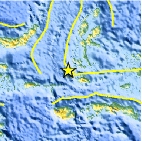
| Location | 0.995°S, 126.850°E |
| Depth | 49 km (30.4 miles) |
| Region | MOLUCCA SEA |
| Distances | 205 km (127 miles) SSW of Ternate, Moluccas, Indonesia 332 km (206 miles) NNW of Ambon, Moluccas, Indonesia 847 km (526 miles) N of DILI, Timor-Leste 1342 km (833 miles) NNW of DARWIN, Northern Territory, Australia |
| Location Uncertainty | horizontal +/- 19.6 km (12.2 miles); depth +/- 11.3 km (7.0 miles) |
| Parameters | NST= 39, Nph= 40, Dmin=454.2 km, Rmss=1.17 sec, Gp= 68°, M-type=body wave magnitude (Mb), Version=5 |
| Source |
|
| Event ID | usc0006zds |
- Did you feel it? Report shaking and damage at your location. You can also view a map displaying accumulated data from your report and others.

Earthquake Maps


Scientific & Technical Information
 Historic Moment Tensor Solutions
- Preliminary Earthquake Report
- U.S. Geological Survey, National Earthquake Information Center:
World Data Center for Seismology, Denver
