
Magnitude 4.9 - SOUTHEAST OF THE LOYALTY ISLANDS
2011 October 04 21:00:28 UTC
Earthquake Details
- This event has been reviewed by a seismologist.
| Magnitude | 4.9 |
|---|---|
| Date-Time |
|
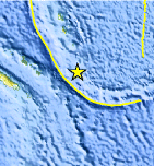
| Location | 21.555°S, 169.997°E |
| Depth | 67.9 km (42.2 miles) |
| Region | SOUTHEAST OF THE LOYALTY ISLANDS |
| Distances | 219 km (136 miles) E of Tadine, Loyalty Islands, New Caledonia 231 km (143 miles) WNW of Ile Hunter, Loyalty Isl., New Caledonia 375 km (233 miles) ENE of NOUMEA, New Caledonia 1759 km (1092 miles) NNW of Auckland, New Zealand |
| Location Uncertainty | horizontal +/- 20.7 km (12.9 miles); depth +/- 9.6 km (6.0 miles) |
| Parameters | NST= 51, Nph= 55, Dmin=371.8 km, Rmss=1.31 sec, Gp= 97°, M-type=body wave magnitude (Mb), Version=5 |
| Source |
|
| Event ID | usc00064ii |
- Did you feel it? Report shaking and damage at your location. You can also view a map displaying accumulated data from your report and others.
Earthquake Maps


Scientific & Technical Information
 Historic Moment Tensor Solutions
- Preliminary Earthquake Report
- U.S. Geological Survey, National Earthquake Information Center:
World Data Center for Seismology, Denver
