
Magnitude 4.6 - SOUTH OF THE FIJI ISLANDS
2011 October 03 15:24:00 UTC
Earthquake Details
- This event has been reviewed by a seismologist.
| Magnitude | 4.6 |
|---|---|
| Date-Time |
|
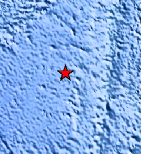
| Location | 23.909°S, 178.871°E |
| Depth | 553.1 km (343.7 miles) |
| Region | SOUTH OF THE FIJI ISLANDS |
| Distances | 446 km (277 miles) SW of Ndoi Island, Fiji 483 km (300 miles) ESE of Ceva-i-Ra, Fiji 636 km (395 miles) S of SUVA, Viti Levu, Fiji 1488 km (924 miles) NNE of Auckland, New Zealand |
| Location Uncertainty | horizontal +/- 19.6 km (12.2 miles); depth +/- 9.4 km (5.8 miles) |
| Parameters | NST= 84, Nph= 87, Dmin=672.4 km, Rmss=1.21 sec, Gp= 76°, M-type=body wave magnitude (Mb), Version=4 |
| Source |
|
| Event ID | usc00063ut |
- Did you feel it? Report shaking and damage at your location. You can also view a map displaying accumulated data from your report and others.
Earthquake Maps


Scientific & Technical Information
 Historic Moment Tensor Solutions
- Preliminary Earthquake Report
- U.S. Geological Survey, National Earthquake Information Center:
World Data Center for Seismology, Denver
