
Magnitude 4.6 - AUCKLAND ISLANDS, NEW ZEALAND REGION
2011 September 30 10:18:27 UTC
Earthquake Details
- This event has been reviewed by a seismologist.
| Magnitude | 4.6 |
|---|---|
| Date-Time |
|
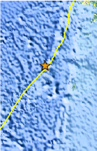
| Location | 49.647°S, 163.679°E |
| Depth | 26.8 km (16.7 miles) |
| Region | AUCKLAND ISLANDS, NEW ZEALAND REGION |
| Distances | 211 km (131 miles) WNW of Auckland Island, New Zealand 501 km (311 miles) SW of Invercargill, New Zealand 636 km (395 miles) SW of Queenstown, New Zealand 1268 km (787 miles) SW of WELLINGTON, New Zealand |
| Location Uncertainty | horizontal +/- 24.9 km (15.5 miles); depth +/- 10.1 km (6.3 miles) |
| Parameters | NST= 26, Nph= 33, Dmin=447.5 km, Rmss=0.89 sec, Gp=133°, M-type=body wave magnitude (Mb), Version=5 |
| Source |
|
| Event ID | usc00062rh |
- Did you feel it? Report shaking and damage at your location. You can also view a map displaying accumulated data from your report and others.
Earthquake Maps


Scientific & Technical Information
 Historic Moment Tensor Solutions
- Preliminary Earthquake Report
- U.S. Geological Survey, National Earthquake Information Center:
World Data Center for Seismology, Denver
