
Magnitude 4.6 - NORTHERN SUMATRA, INDONESIA
2011 September 14 10:37:02 UTC
Earthquake Details
- This event has been reviewed by a seismologist.
| Magnitude | 4.6 |
|---|---|
| Date-Time |
|
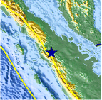
| Location | 0.755°N, 100.034°E |
| Depth | 189.3 km (117.6 miles) |
| Region | NORTHERN SUMATRA, INDONESIA |
| Distances | 108 km (67 miles) SE of Padangsidempuan, Sumatra, Indonesia 160 km (99 miles) W of Pekanbaru, Sumatra, Indonesia 176 km (109 miles) SE of Sibolga, Sumatra, Indonesia 1076 km (668 miles) NW of JAKARTA, Java, Indonesia |
| Location Uncertainty | horizontal +/- 20.1 km (12.5 miles); depth +/- 11 km (6.8 miles) |
| Parameters | NST= 63, Nph= 67, Dmin=121.3 km, Rmss=0.85 sec, Gp= 58°, M-type=body wave magnitude (Mb), Version=6 |
| Source |
|
| Event ID | usc0005u5k |
- Did you feel it? Report shaking and damage at your location. You can also view a map displaying accumulated data from your report and others.

Earthquake Maps


Scientific & Technical Information
 Historic Moment Tensor Solutions
- Preliminary Earthquake Report
- U.S. Geological Survey, National Earthquake Information Center:
World Data Center for Seismology, Denver
