
Magnitude 4.7 - HALMAHERA, INDONESIA
2011 May 07 05:48:44 UTC
Earthquake Details
- This event has been reviewed by a seismologist.
| Magnitude | 4.7 |
|---|---|
| Date-Time |
|
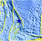
| Location | 2.908°N, 128.599°E |
| Depth | 219.9 km (136.6 miles) |
| Region | HALMAHERA, INDONESIA |
| Distances | 271 km (168 miles) NNE of Ternate, Moluccas, Indonesia 445 km (276 miles) ENE of Manado, Sulawesi, Indonesia 816 km (507 miles) SW of KOROR, Palau 1540 km (956 miles) SSE of MANILA, Philippines |
| Location Uncertainty | horizontal +/- 19 km (11.8 miles); depth +/- 10 km (6.2 miles) |
| Parameters | NST= 85, Nph= 85, Dmin=761.4 km, Rmss=0.99 sec, Gp= 61°, M-type=body wave magnitude (Mb), Version=5 |
| Source |
|
| Event ID | usc0003864 |
- Did you feel it? Report shaking and damage at your location. You can also view a map displaying accumulated data from your report and others.

Earthquake Maps


Scientific & Technical Information
 Historic Moment Tensor Solutions
- Preliminary Earthquake Report
- U.S. Geological Survey, National Earthquake Information Center:
World Data Center for Seismology, Denver
