
Magnitude 4.4 - FIJI REGION
This webpage has been replaced by a new version and will be phased out in the future. Please use our new Real-time Earthquake Map to access the latest earthquake information and event details. The links to the World, US, and CA/NV maps that were in the navigation on the left side of the page have been replaced by the links at the top of the new Map. The Real-time Earthquake Map User Guide describes how to use the map and all its features.
2012 May 27 18:40:24 UTC
Earthquake Details
- This event has been reviewed by a seismologist.
| Magnitude | 4.4 |
|---|---|
| Date-Time |
|
| Location | 21.989°S, 179.416°W |
| Depth | 486.8 km (302.5 miles) |
| Region | FIJI REGION |
| Distances | 166 km (103 miles) SSW of Ndoi Island, Fiji 447 km (277 miles) WSW of NUKU`ALOFA, Tonga 483 km (300 miles) SSE of SUVA, Viti Levu, Fiji 1742 km (1082 miles) NNE of Auckland, New Zealand |
| Location Uncertainty | horizontal +/- 28.1 km (17.5 miles); depth +/- 11.4 km (7.1 miles) |
| Parameters | NST= 39, Nph= 39, Dmin=>999 km, Rmss=1.19 sec, Gp=133°, M-type=body wave magnitude (Mb), Version=A |
| Source |
|
| Event ID | usb000a0sr |
- Did you feel it? Report shaking and damage at your location. You can also view a map displaying accumulated data from your report and others.
Earthquake Maps

Recent Activity At This Location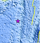
Location Maps
Historical Seismicity
Seismic Hazard Map
Google Map
Google Earth KML
(Requires Google Earth)- Did you feel it? Report shaking and damage at your location. You can also view a map displaying accumulated data from your report and others.
Scientific & Technical Information
 Historic Moment Tensor Solutions
- Preliminary Earthquake Report
- U.S. Geological Survey, National Earthquake Information Center:
World Data Center for Seismology, Denver
