
Magnitude 4.8 - EASTERN NEW GUINEA REG, PAPUA NEW GUINEA
2011 October 30 04:01:27 UTC
Earthquake Details
- This event has been reviewed by a seismologist.
| Magnitude | 4.8 |
|---|---|
| Date-Time |
|
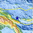
| Location | 5.429°S, 147.188°E |
| Depth | 185.7 km (115.4 miles) |
| Region | EASTERN NEW GUINEA REG, PAPUA NEW GUINEA |
| Distances | 145 km (90 miles) N of Lae, New Guinea, PNG 155 km (96 miles) E of Madang, New Guinea, PNG 446 km (277 miles) N of PORT MORESBY, Papua New Guinea 2519 km (1565 miles) NNW of BRISBANE, Queensland, Australia |
| Location Uncertainty | horizontal +/- 19.2 km (11.9 miles); depth +/- 8.1 km (5.0 miles) |
| Parameters | NST= 24, Nph= 26, Dmin=375.1 km, Rmss=0.54 sec, Gp= 58°, M-type=body wave magnitude (Mb), Version=3 |
| Source |
|
| Event ID | usb0006ggt |
- Did you feel it? Report shaking and damage at your location. You can also view a map displaying accumulated data from your report and others.

Earthquake Maps


Scientific & Technical Information
 Historic Moment Tensor Solutions
- Preliminary Earthquake Report
- U.S. Geological Survey, National Earthquake Information Center:
World Data Center for Seismology, Denver
