
Magnitude 4.8 - KEPULAUAN BARAT DAYA, INDONESIA
2010 October 26 11:19:45 UTC
Earthquake Details
- This event has been reviewed by a seismologist.
| Magnitude | 4.8 |
|---|---|
| Date-Time |
|
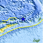
| Location | 7.598°S, 128.320°E |
| Depth | 197.6 km (122.8 miles) |
| Region | KEPULAUAN BARAT DAYA, INDONESIA |
| Distances | 320 km (200 miles) ENE of DILI, Timor-Leste 335 km (205 miles) W of Saumlaki, Kepulauan Tanimbar, Indonesia 430 km (270 miles) S of Ambon, Moluccas, Indonesia 605 km (375 miles) NNW of DARWIN, Northern Territory, Australia |
| Location Uncertainty | horizontal +/- 19.5 km (12.1 miles); depth +/- 1.7 km (1.1 miles) |
| Parameters | NST= 33, Nph= 36, Dmin=331.7 km, Rmss=1.11 sec, Gp= 58°, M-type=body wave magnitude (Mb), Version=5 |
| Source |
|
| Event ID | usa00044mi |
- Did you feel it? Report shaking and damage at your location. You can also view a map displaying accumulated data from your report and others.

Earthquake Maps


Scientific & Technical Information
- Preliminary Earthquake Report
- U.S. Geological Survey, National Earthquake Information Center:
World Data Center for Seismology, Denver
