
Magnitude 4.7 - SOLOMON ISLANDS
2011 October 30 15:34:05 UTC
Earthquake Details
- This event has been reviewed by a seismologist.
| Magnitude | 4.7 |
|---|---|
| Date-Time |
|
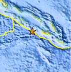
| Location | 9.523°S, 158.635°E |
| Depth | 10 km (6.2 miles) set by location program |
| Region | SOLOMON ISLANDS |
| Distances | 144 km (89 miles) W of HONIARA, Guadalcanal, Solomon Islands 168 km (104 miles) SSW of Dadali, Santa Isabel, Solomon Islands 241 km (149 miles) WSW of Auki, Malaita, Solomon Islands 2076 km (1289 miles) NNE of BRISBANE, Queensland, Australia |
| Location Uncertainty | horizontal +/- 14.9 km (9.3 miles); depth fixed by location program |
| Parameters | NST= 15, Nph= 15, Dmin=144.4 km, Rmss=1.05 sec, Gp= 90°, M-type=body wave magnitude (Mb), Version=5 |
| Source |
|
| Event ID | us2011srbb |
- Did you feel it? Report shaking and damage at your location. You can also view a map displaying accumulated data from your report and others.
Earthquake Maps


Scientific & Technical Information
 Historic Moment Tensor Solutions
- Preliminary Earthquake Report
- U.S. Geological Survey, National Earthquake Information Center:
World Data Center for Seismology, Denver
