
 Feeds & Data
Magnitude 4.7 - SOUTH OF THE FIJI ISLANDS
2009 April 08 19:48:12 UTC
Earthquake Details
| Magnitude | 4.7 |
|---|---|
| Date-Time |
|
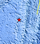
| Location | 23.694°S, 179.815°E |
| Depth | 524.7 km (326.0 miles) |
| Region | SOUTH OF THE FIJI ISLANDS |
| Distances | 370 km (230 miles) SSW of Ndoi Island, Fiji 580 km (360 miles) ESE of Ceva-i-Ra, Fiji 630 km (395 miles) SSE of SUVA, Viti Levu, Fiji 1545 km (950 miles) NNE of Auckland, New Zealand |
| Location Uncertainty | horizontal +/- 16.8 km (10.4 miles); depth +/- 10.6 km (6.6 miles) |
| Parameters | NST= 26, Nph= 26, Dmin=656.3 km, Rmss=0.93 sec, Gp= 86°, M-type=body wave magnitude (Mb), Version=Q |
| Source |
|
| Event ID | us2009feb3 |
- This event has been reviewed by a seismologist.
- Did you feel it? Report shaking and damage at your location. You can also view a map displaying accumulated data from your report and others.
Earthquake Maps


Scientific & Technical Information
 Historic Moment Tensor Solutions
- Preliminary Earthquake Report
- U.S. Geological Survey, National Earthquake Information Center:
World Data Center for Seismology, Denver
