
Poster of the Lapas, Greece Earthquake of 08 June 2008 - Magnitude 6.4
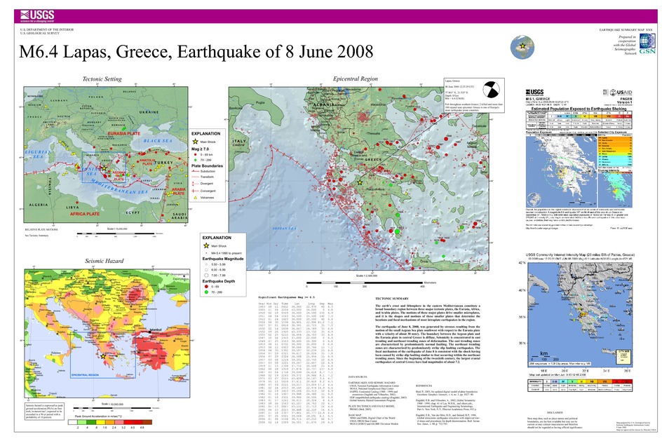
Tectonic Summary
The earth's crust and lithosphere in the eastern Mediterranean constitute a broad boundary region between three major tectonic plates, the Eurasia, Africa, and Arabia plates. The motions of these major plates drive smaller microplates, and it is the shapes and motions of these smaller plates that determine the locations and focal mechanisms of most intraplate earthquakes in the region.
The earthquake of June 8, 2008, was generated by stresses resulting from the motion of the small Aegean Sea plate southwest with respect to the Eurasia plate with a velocity of about 30 mm/y. The boundary between the Aegean plate and the Eurasia plate in central Greece is diffuse. Seismicity is concentrated in east-trending and northeast-trending zones of deformation. The east-trending zones are characterized by predominantly normal faulting. The northeast-trending zones are characterized by predominately strike-slip faulting earthquakes. The focal-mechanism of the earthquake of June 8 is consistent with the shock having been caused by strike-slip faulting similar to that occurring within the northeast-trending zones. Since the beginning of the twentieth century, the largest crustal earthquakes of central Greece have had magnitudes of about 7.2.
Downloads

Settings
The posters may be downloaded for viewing or for printing on a color
plotter. Adobe PDF (.pdf) format files are provided. Adobe Acrobat 6.0 or
higher is required for viewing the PDF file on a computer monitor and for
printing the PDF map graphic. IMPORTANT: The PDF map graphic was produced
using TrueType fonts; change the following setting to:
Page(Print)Setup<Properties<Layout<Advanced<Graphic<TrueTypeFont<DownloadAsSoftFont
Attention MAC users: If you have problems viewing the pdf files, please download the pdf file and view it in the lastest verion of Adobe Acrobat.
