
Poster of the Solomon Islands Earthquake of 01 April 2007 - Magnitude 8.1
Tectonic Summary
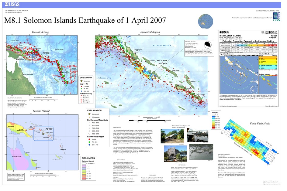
The Solomon Islands earthquake of April 1, 2007, occurred along the boundary of the Pacific plate with, respectively, the Australia, Woodlark, and Solomon Sea plates. The latter three plates converge to the east-northeast or northeast against the Pacific plate with velocities of 90-105 mm/y. Along much of the plate boundary between the Pacific plate and the Australia/Woodlark/Solomon Sea plates, relative plate-motion is accomplished principally by subduction of the Australia/Woodlark/Solomon Sea plates beneath the Pacific plate. The April 1 earthquake's location and focal mechanism are consistent with the earthquake having occurred as underthrusting of the Australia/Woodlark/Solomon Sea plate beneath the Pacific plate, as part of the broader northeast-directed subduction process.
The Solomon Islands arc as a whole experiences a very high level of earthquake activity, and many shocks of magnitude 7 and larger have been recorded since the early decades of the twentieth century. The April 1 earthquake, however, nucleated in a 250-long segment of the arc that had produced no shocks of magnitude 7 or larger since the early 20th century.
Downloads

Settings
The posters may be downloaded for viewing or for printing on a color
plotter. Adobe PDF (.pdf) format files are provided. Adobe Acrobat 6.0 or
higher is required for viewing the PDF file on a computer monitor and for
printing the PDF map graphic. IMPORTANT: The PDF map graphic was produced
using TrueType fonts; change the following setting to:
Page(Print)Setup<Properties<Layout<Advanced<Graphic<TrueTypeFont<DownloadAsSoftFont
Attention MAC users: If you have problems viewing the pdf files, please download the pdf file and view it in the lastest verion of Adobe Acrobat.
