
Poster of the Kuril Islands Earthquake of 15 November 2006 - Magnitude 8.3
Tectonic Summary
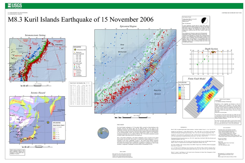
The Kuril Islands earthquake of 15 November 2006, occurred as thrust-faulting on the boundary between the Pacific plate and the Okhotsk plate. In the region of the earthquake's epicenter, the Pacific plate moves northwest with respect to the Okhotsk plate with a velocity of about 90 mm/year. The Pacific plate subducts beneath the Okhotsk plate at the Kuril-Kamchatka Trench and becomes progressively deeper to the northwest, remaining seismically active to a depth of 680 km. The 15 November mainshock occurred at shallow depth within about 80 km of the trench axis.
The 15 November earthquake is the largest earthquake to have occurred in the central Kuril Islands since the early 20th century. A central Kuril Islands earthquake in 1915 is estimated to have had a magnitude of about 8. The central Kuril Islands commonly experiences one or more shocks of magnitude 6 or greater in a decade. To the southwest, the southern Kuril Islands chain experienced a magnitude 8.5 earthquake in 1963. To the northeast, a magnitude 9 earthquake occurred offshore of Kamchatka in 1952.
Downloads

Settings
The posters may be downloaded for viewing or for printing on a color
plotter. Adobe PDF (.pdf) format files are provided. Adobe Acrobat 6.0 or
higher is required for viewing the PDF file on a computer monitor and for
printing the PDF map graphic. IMPORTANT: The PDF map graphic was produced
using TrueType fonts; change the following setting to:
Page(Print)Setup<Properties<Layout<Advanced<Graphic<TrueTypeFont<DownloadAsSoftFont
Attention MAC users: If you have problems viewing the pdf files, please download the pdf file and view it in the lastest verion of Adobe Acrobat.
