
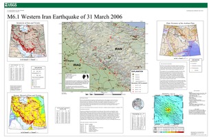
Poster of the Western Iran Earthquake of 31 March 2006 - Magnitude 6.1
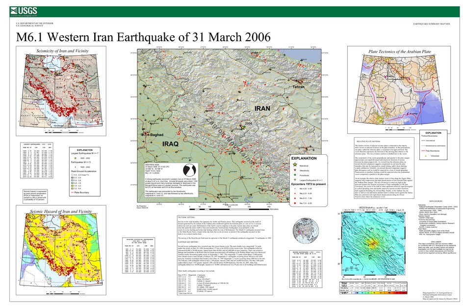
Tectonic Summary
Iran lies in the wide boundary that separates the Arabia and Eurasia plates. This earthquake occurred as the result of stresses generated by the motion of the Arabian plate northward against the Eurasian plate at a rate of 2 to 3 cm/year (about one inch per year). Deformation of the Earth's crust in response to the plate motion takes place in a broad zone that spans the entire width of Iran and extends into Turkmenistan. Earthquakes occur primarily as the result of reverse faulting and strike-slip faulting within the zone of deformation. The March 31 earthquake occurred close to the Main Recent Fault, a major strike-slip fault, but we do not know at present if the earthquake occurred on that fault or on a related smaller fault. The section of the Main Recent Fault near the epicenter of the March 31 earthquake produced a magnitude 7.4 earthquake in 1909.
Earthquake History
Several severe earthquakes have occurred near this recent Iranian event. The most deadly was a magnitude 7.4 earth- quake that struck on June 20, 1990, located about 175 km to the WNW of this recent event. This earthquake killed an estimated 40,000 to 50,000 people, injured more than 60,000, and left 400,000 or more homeless. There was extensive damage and landslides in the Rasht-Qazvin-Zanjan area and nearly all buildings in the Rudbar-Manjil area were destroyed. Another nearby devastating quake struck on September 1, 1962. This magnitude 7.3 quake killed about 12,000 people. More distant recent events include a February 28, 1997 magnitude 6.1 earthquake occurring about 300 km to the north (near the Armenia-Azerbaijan-Iran border), and a May 10, 1997 magnitude 7.3 event occurring about 1000 km to the east. The February 28th earthquake killed at least 1,100 people, injured 2,600, and left 36,000 homeless. The May 10th earth- quake killed at least 1,567 people, injured 2,300, and left about 50,000 homeless. The Dec 26, 2003, Bam, Iran, earthquake killed over 30,000 people, injured over 30,000, and destroyed over 85 per cent of all buildings and infrastructure.
Other deadly earthquakes occurring in Iran include:
| Date (UTC) | Magnitude | Comments |
|---|---|---|
| 1957 12 13 | 7.3 | 130 killed * |
| 1963 03 24 | 7.2 | About 100 killed * |
| 1983 07 22 | 5.6 | 3 killed, 41 injured |
| 1990 06 21 | 5.8 | At least 20 killed (aftershock of 1990 06 20) |
| 1991 11 28 | 5.6 | 1 killed, 70 injured |
| 2002 06 22 | 6.5 | 261 killed, 1300 injured |
| 2003 12 26 | 6.8 | 30,000 killed, 30,000 injured |
| 2004 05 28 | 6.3 | 20 killed, 150 injured |
| * Data from NOAA | ||
Downloads
Settings
The posters may be downloaded for viewing or for printing on a color
plotter. Adobe PDF (.pdf) format files are provided. Adobe Acrobat 6.0 or
higher is required for viewing the PDF file on a computer monitor and for
printing the PDF map graphic. IMPORTANT: The PDF map graphic was produced
using TrueType fonts; change the following setting to:
Page(Print)Setup<Properties<Layout<Advanced<Graphic<TrueTypeFont<DownloadAsSoftFont
Attention MAC users: If you have problems viewing the pdf files, please download the pdf file and view it in the lastest verion of Adobe Acrobat.
