Geoscience Australia

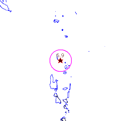
Recent Earthquake : Vanuatu Islands region.

Geoscience Australia
earthquake epicentre map: Vanuatu Islands region.

scalebar

Earthquake Details:

Date:08/09/2008
Time (UTC) hh:mm:ss:18:52:07
Latitude:-13.470
Longitude:166.940
Depth (km):115
Magnitude:6.9
Felt radius:1128 km (approx)
Damage radius:90 km (approx)


View a seismogram of the earthquake
(Adobe PDF format)

(only available for 90 days from date of earthquake)

See other seismograms of this earthquake.

Seismic station information

Change background:

Earthquake risk
Geological regions

Geological faults

show map legend

Change zoom level:

apply background and zoom level changes

reference map
Reference map

Recent Earthquakes List